Blog Archive

Monday, August 30, 2010

Lander WY RS

We left Teton Valley RV Park and backtracked on Rt.31 to RT. 26 that took us around the mountain that Teton Pass, with it’s 10% grades, is located on. Our route took along the Snake River and another earth fill dam.


Pictures of this portion of our trip are on Shutterfly at: http://jackbarbic.shutterfly.com/4706


We had another opportunity to see the Teton Mountain Range as we continued north on Rt.26 towards Yellowstone. The Rt.26 heads north until it intersects with the road that leads to both Teton National Park and Yellowstone. It then turns toward the south east. As we went along, nearing the Togowotee Pass (el. 9658 ft.) with 6% grades, we were behind a “side dump” truck. It’s about the length of a semi, the “trailer” is semi-circular, open on top and rotates to dump it’s contents. The truck was loaded and chugging up the pass at no more than 20 mph. Being a narrow two lane road there was no way I would be able to pass so I slowed and ended up with the motor home in low gear. I was pleased at how well it did. Anyway, even if I could have passed it’s a good thing I didn’t. Traffic was stopped near the summit due to road construction. The flag man waved the trunk around the line of stopped cars, turns out the truck was hauling gravel for the road. After sitting a while, I took the opportunity to get out of the motor home just as some irate woman walked by wanting to know “What’s going on” and “How long are we going to be here”. I suggested she talk to the flag man. Times like this is when a motor home is wonderful. We have running water, we have food in the fridge, we can generate electricity to power the microwave (Jackie made us a sandwich while we were waiting) AND WE HAVE A BATHROOM.

After a while a pilot car (truck) showed up and it was time to go. The construction spanned a few miles but at least it was not muddy and messy like the construction we went through in Montana and the detour we took in Nebraska due to the washed out bridge. Unfortunately the paper plat e, the sandwiches now eaten, was on the dash and the reflection shows up in the pictures of the construction.


One thing I’ve noticed on this trip is that there are many places I see that are not the same as but are very similar to places/parks that I’ve been to. The photos below remind me of Brice Canyon and the red rocks in vicinity of Sedona AR.


Later in the day we arrived at Twin Pines campground in Lander WY.

The next day we went to see the burial places of Chief Washakie and Sacajawea. Theses two were very unique people that contributed much to the history of our west. Washakie was born in 1798 and died in1900. He rose to a position of leadership when he united bands of Shoshone warriors. Besides his native language, Washakie was taught English and French by the fur traders. He understood that the Indians could not stop the westward movement of the settlers. He was able to persuade the Shoshone bands to move away from the migration route and negotiate with the army to retain the Warm Valley of the Wind for the Shoshone. He was successful and signed the Fort Bridger Treaty between the American Indian Community and the US Government that established a reservation of more thirteen million acres and included the Warm Valley region. When he died he was given a full military funeral, the only given to an Indian Chief. The cavalry from Fort Washakie provided the escort and the procession was nearly two miles long.


Sacajawea was a Shoshone and about 16 and pregnant when she and her French Canadian husband joined the Lewis & Clark Expedition. Her son was born during the Expedition’s first winter camp at Fort Mandan. Her presents along with her baby prevented the expedition from being attacked by the many tribes they encountered. The Indians believed that they were a peaceful expeditions because war parties never had women and children with them. Besides her skills as a guide, she was instrumental in negotiating and using her heritage for supplies that the expedition needed. Truly a remarkable woman. There are more picture with information about her in the album.


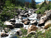
The following day we went to Sinks Canyon State Park. The name come from the river, which flows through the canyon and at about the half way point turns into a limestone cavern and sinks into the ground, known as “The Sink“. It emerges about a quarter mile away, known as “The Rise“.


At “The Rise” is a pool that is loaded with large brown and rainbow trout. They are almost like pets. The state has installed vending machines that visitors can feed the trout pellets of fish food. Considering their size I would suspect many visitors have fed them well. As you might expect, no fishing is allowed. It would be like catching and eating your pet goldfish.

The river has a unique name, Popo Agie. The pronunciation is Po-Po-shuh although a recording and some locals pronounced it Pop-a-shuh.


We are now in Superior CO visiting our son, daughter-in-law and grandchildren. Since we plan to be here until a day or two after l Labor Day, I have put the motor home in a self storage lot in Boulder.

When we leave, we will most likely take I-70 & I-64 eastward with the intention of stopping in Ashland KY for several days. Jackie was doing some digging into her ancestors and discovered that her mother’s step sister had children that are our age, Jackie discovered them, by accident, on ancestry.com when she and her newly found cousin were researching their grandfather. From there it will be time to head south and home.

Jack

Sunday, August 22, 2010

Teton Mountain Range & Yellowstone


We are staying at an RV park in Victor ID just west of the Teton Mountains. When we were looking for a location that was at a lower altitude but close to the park. On the map it looked like a short drive on Rt. 22 to Jackson. After we made our arrangements, I was looking for a route to our next stop, which will be Lander Wyoming. It was going to be a short hop, under 200 miles. Then, I thought I’d better check my Mountain Directory. It is a publication that lists, mountain passes with information on the grade, turns and truck runoff areas. Turns out Rt.22 traverses the Teton Pass, it has weight and length restrictions due to a grade in the east and west direction of 10%. When were checking in I asked the people at the RV park about it and they were unanimous in their response “DO NOT TRY TO TAKE YOU MOTOR HOME OVER THE PASS!!!”. Sooooo, I will be back tracking and taking the long way around the mountain which adds about 85 miles to the trip. We drove the pass for the two days we were here and it gave the car (and Jackie) a pretty good workout. There were several times when were climbing that we could smell the hot brake aroma of cars coming down the grade.


There’s an expression about biting off more than you can chew. We don’t heed that advice often. What was going to be a couple of easy days seeing the Tetons and Jackson Hole turned out to be something else when we agreed that since Yellowstone was so close we might as well see it too. The slow touring turned out to be a power trip. But, it was worth it.

The picture album is at:  http://jackbarbic.shutterfly.com/4556

On our first trip over Teton Pass just east of the summit we saw this sign. A stop at the visitor’s center is always worth while. It is an excellent source for maps and route, but more importantly you get tips about the area that you can’t always get of the printed material.


A short drive north of Jackson brings you to the Tetons. What a sight! Once again the pictures fail to give the visual impact you get when you seen them with your own eyes. We made several stops at the viewing turnouts along Rt. 26. And took way too many picture of essentially the same mountains. Hear are a couple of panorama shots.


The Tetons are between 6 and 9 million years old. The peaks are sharp because they are relatively young mountain and that the glaciers were not deep enough to cover the peaks. Not that they were puny as the depth is estimated to be 3000 feet. The Snake River runs through the valley. We came to a sign that gave the names of the individual mountains in the Teton Range


After we entered Teton Park, we stopped at the Oxbow Bend Turnout. There was little breeze and the river was calm enough to see the mountains reflection. We went on to Yellowstone after that. The next day we returned to drive the loop through Grand Teton National Park that is the next junction after Oxbow Bend. We stopped at the Jackson Lake Dam.


The view from the lakeside of the dam.


So, on to Yellowstone. When you are in Yellowstone you are actually in a caldera that is still feeling the effects of the hot magma that underlies the area.


We entered the park at the south entrance and drove for several mile in a pine forest . There is evidence of past forest fires, remains of the burnt trees can be seen along with the new growth. In Glacier Park a ranger told us that dead trees are allowed to disintegrate and become part of the soil.


There are areas that can be dangerous if you do not heed the warning signs. The ground is being heated from below and water, steam, mud, etc are at temperatures that cause major damage to people.


The Upper and especially Lower Falls are a must to see, but the canyon below the Lower Falls, known as the “Grand Canyon of Yellowstone” is spectacular and is another one of those “Oh Wow“ when you first see it. The canyon is about 900 feet deep and a half mile wide. Water flowing over the falls comes from Yellowstone Lake via the Yellowstone River The river is approximately 692 long and is a tributary of the Missouri River. At the Upper and Lower Falls there are stairs that will allow a viewer to see what the falls look like from a lower, however, it’s tough on geezers with less than good knees.


The Buffalo were out and about. I was able to get a picture of one crossing the river and part of a herd that decided to cross the road. They don’t look both ways before crossing, they walk, traffic stops.


There are many signs warning people not to approach the wild animals but you know, if you can just get a little closer to get that special picture……………..


We saw many trees with the bark missing on the  lower trunk. This looks like it is caused by the bison rubbing against the tree.

So late in the day we started back to the campground and another drive over the Teton Pass. There have been so many places that we would want to have stayed longer. But we left home way back on May 21 and as I write this, we have been gone a day over three months. Our getting home date keeps getting pushed back. Looks like we will return home around the end of September but, when you are on “RV Time” schedules tend to slip.